What is the ISC-EHB Bulletin? The ISC-EHB Dataset is a groomed version of the ISC Bulletin, and contains 208480 Seismic events from 1964 to 2021, where the period 1964-2008 has been rebuilt. The total number of 47206228 time defining seismic phases are associated with the ISC-EHB dataset. Teleseismically well-constrained events are selected from the ISC Bulletin, and are relocated using the EHB algorithm (Engdahl et al., 1998) to minimise errors in location (particularly depth) due to assumed 3D Earth structure.
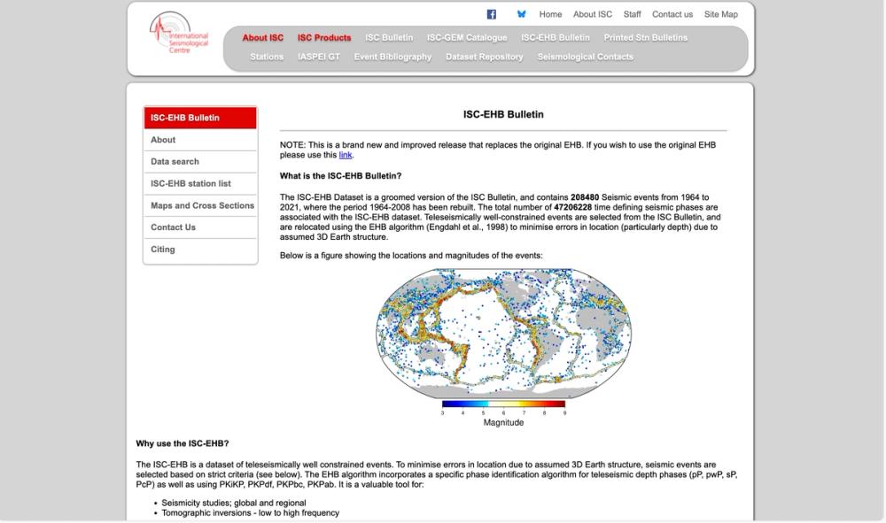
Below is a figure showing the locations and magnitudes of the events:
Locations and magnitudes of the ISC-EHB events
Why use the ISC-EHB? The ISC-EHB is a dataset of teleseismically well constrained events. To minimise errors in location due to assumed 3D Earth structure, seismic events are selected based on strict criteria (see below). The EHB algorithm incorporates a specific phase identification algorithm for teleseismic depth phases (pP, pwP, sP, PcP) as well as using PKiKP, PKPdf, PKPbc, PKPab. It is a valuable tool for:
Seismicity studies; global and regional Tomographic inversions - low to high frequency We do not advise using this dataset for seismic hazard studies or any other studies that require completeness to a certain level of magnitude.
How is it different from EHB? The original EHB stopped in 2008, and since then the volume and quality of data has significantly improved. To take this into account we have updated event selection, data preparation and processing, and relocation procedures (described below). This enables us to produce a cleaner and more robust dataset.
We have applied this approach to events in 1964-2021, and this new dataset has replaced the equivalent years in EHB, (for a full description of this click this link). Over the next few years we shall go beyond 2021 to extend the ISC-EHB to the present day.
Searching the ISC-EHB database The database covers years 1964-2021. The strength of the ISC-EHB is the constraint on depth, and some depths are slightly better constrained than others. This slight variation in depth constraint, depending on what you are using it for, may influence whether you use all or part of the dataset. To help with this decision we have split the depths up into three categories:
Level 1 (L1) - Free depth with standard error < 5 km, and at least 3 defining depth phases, OR fixed depth will be constrained by depth phases, OR by USGS broadband depths.
Level 2 (L2) - Free depth with standard error 5-15 km, OR a fixed depth based on the GCMT solution.
Level 3 (L3) - Free depth with error > 15 km OR fixed depth based on review of local/nearby seismicity, or seismic regions.
Level 1 can be thought of as the 'gold standard' of depths in this dataset, level 2 is slightly less well constrained and level 3 is the least well constrained.
We will add the depth categories as a new search criteria in the near future.
Maps and cross sections New to ISC-EHB are cross sections of seismicity in subduction zones around the world. An example map and cross section for the Kermadec region is shown below. Click here, or on the map or cross section below, to see all maps and cross sections, and get more information.


